(Sejong = Yonhap News) Reporter Yoon Jong-seok = While the next-generation medium-sized satellite 1 has been successfully launched and settled in orbit, attention is focused on the utilization of this satellite.
According to the Ministry of Land, Infrastructure and Transport on the 22nd, this satellite was developed for precise ground observation, and is the main ministry of use by the Ministry of Land, Infrastructure and Transport.
The National Territory Satellite Center installed at the National Geographic Information Institute will process the precision ground observation images provided by the Korea Aerospace Research Institute into high-quality (position accuracy 1 to 2 m) precision orthogonal images and provide them to the demanding organizations quickly.

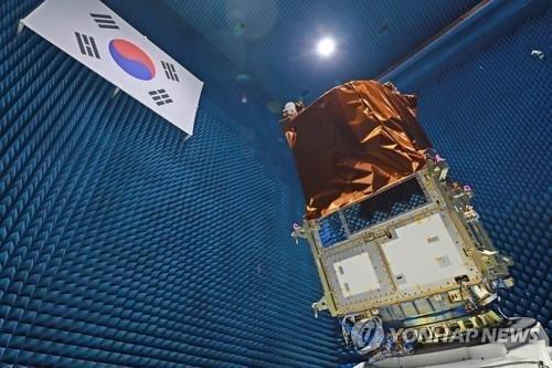
Next-generation medium-sized satellite No. 1 undergoing electromagnetic environmental testing. 2021.3.22 [한국항공우주연구원 제공. 연합뉴스 자료사진. 재판매 및 DB 금지]
An orthogonal image is an image obtained by correcting geometric distortion caused by topographic undulations such as height difference or inclination, and transforming the satellite image into a view when all objects are viewed vertically.
The national territorial satellite is used in a variety of public and private sectors, such as national territory and resource management, and disaster and disaster response.
Thanks to satellites, the period of periodic monitoring of land use, topography, water systems, and infrastructure is greatly reduced from the previous two years to 4.6 days.
In the event of a disaster or disaster, the satellite will identify the damage in the area and provide analysis data such as establishment of a recovery plan.
Precise ground observation images obtained through the National Land Satellite are also used as basic data to build the’digital twin’, the core task of the Korean version of the New Deal.
In addition, it is expected to contribute greatly to creating various convergence industries such as support for new industries such as smart cities, autonomous driving, and drones, and disaster safety services.
The Ministry of Land, Infrastructure, and Transport plans to actively discover overseas projects by linking and providing filmed images overseas with various service platforms.
Nam Yeong-woo, Minister of Land, Infrastructure, and Information Policy of the Ministry of Land, Infrastructure and Transport said, “We plan to provide active support so that the images of the National Territory Satellite can be used to improve the quality of people’s lives and develop various industries by preparing the necessary matters for full-scale operation and video provision of the National Land Satellite. .
Unauthorized reproduction-redistribution prohibited>
2021/03/22 18:08 sent
