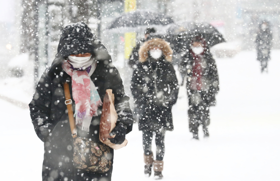
Citizens walking with eye contact in Seo-gu, Daejeon, where heavy snow warning was issued on the 18th. The Meteorological Administration predicted that snow would fall across the country on the 28th. News 1
On the 28th, a long snow cloud extending north and south falls on the whole country. After the snow has passed, the strong cold comes again.
Through a briefing on the 27th, the Meteorological Administration predicted that rain or sleet will begin to fall from the west on the morning of the 28th, and will expand throughout the country during the day, and strong snow will accumulate at one time during the day.
Longer snow clouds north-south, more snow in the east

A schematic diagram of the expected barometer around the Korean Peninsula on the afternoon of the 28th. A cold, strong low-pressure vortex (yellow circle) passes through the northern part of the Korean Peninsula, followed by a relatively less cold and strong high-pressure pressure, creating a kind of’front line’ between the two barometric pressure zones. Along this front, it is expected that a long snow cloud will be formed from north to south of Korea. Materials Meteorological Agency
This snow is formed by a strong cyclone vortex passing through the northern part of the Korean Peninsula. A relatively less cold high pressure approaches behind the cold vortex passing through the 28th, creating a cold composition in the east and a warm composition in the west. In the meantime, a long snow cloud zone is formed from north to south along the’front line’, and it is expected to fall all over the country. This snow cloud is pushed by a strong wind and quickly escapes southeast.

Estimated snowfall from 28 to 29. Snow falls across the country on the 28th and in southern Jeolla on the 29th. On the 28th, it is expected that there will be a lot of snow in the eastern part of Gyeonggi Province and Gangwon-do, where the temperature is low, and on the 29th, it is expected that additional snow will fall only in the southern part of Jeolla due to the influence of snow clouds formed in the west sea. Materials Meteorological Agency
As the temperature difference between the east and the west is large, it is expected that more snow will fall in the eastern region, where the temperature is lower. In the eastern part of Gyeonggi Province and Gangwon-do, etc., a maximum of 10 cm or more, and the inland of Jeolla East, which is affected by additional snow cloud zones on the west coast, is expected to accumulate snow at a maximum of 15 cm by the 29th, and a heavy snow warning is expected to be issued.
It is expected that 1~5cm of snow will accumulate in other areas including the metropolitan area. There is also the possibility of thunder and lightning due to atmospheric instability.
On the 28th, the strong cold begins after the snow… Beware of the ice on the way home from work

From the afternoon of the 28th, the temperature drops sharply as cold air enters. In many places, the minimum temperature in the morning of the 29th and 30th falls below -15 degrees Celsius, and a cold wave warning is expected to be issued. Materials Meteorological Agency
Woo Jin-gyu, forecast analyst at the Meteorological Administration, said, “Snow and rain are mixed at 3 degrees below zero, snow at minus 4 degrees, and snow at minus 5 degrees.” In the case of the metropolitan area, 10 cm of snow accumulates in eastern Gyeonggi Province, but the temperature in Seoul falls that much. It doesn’t seem like it, so I expect 1~5cm of snowfall.”
However, he added that “the 28th daytime temperature between minus 3°C and minus 5°C can change the amount of snow cover even with a small change, so there is great variability.” “We will continue to produce additional forecasts.”
After snow passes, the temperature drops sharply as cold air enters. On the 29th and 30th, the minimum temperature in the morning drops below -10 degrees Celsius in the central and southern mountainous areas, and the wind blows hard, making the cold feel stronger. Analyst Woo said, “After the snow falls on the 28th, the temperature starts to drop below freezing in the afternoon, and you should be careful about freezing the road from the way home on the 28th.”
’70km/h’ Small typhoon class wind blows
The wind blows strongly between strong low and high high pressures. As the air from the north is strongly drawn in, strong winds of 25 to 65 km/h are expected throughout the country from the morning of the 28th, and strong wind warnings are expected to be issued in most regions. It is expected that a’small typhoon class’ strong wind will blow up to 90km/h in the coast, Jeju Island, and mountainous areas, and 70km/h in other areas including the city center. The wind is expected to continue until the 29th.
A storm warning is issued on the sea from the 28th due to the influence of the wind. A storm warning continues until the 29th in the West Sea and until the 30th in the South Sea and East Sea. Analyst Woo said, “A maximum of 5m and a maximum of 8m in the far sea in the East Sea are expected to evacuate as much as possible. I will do it.”
Reporter Kim Jeongyeon [email protected]
