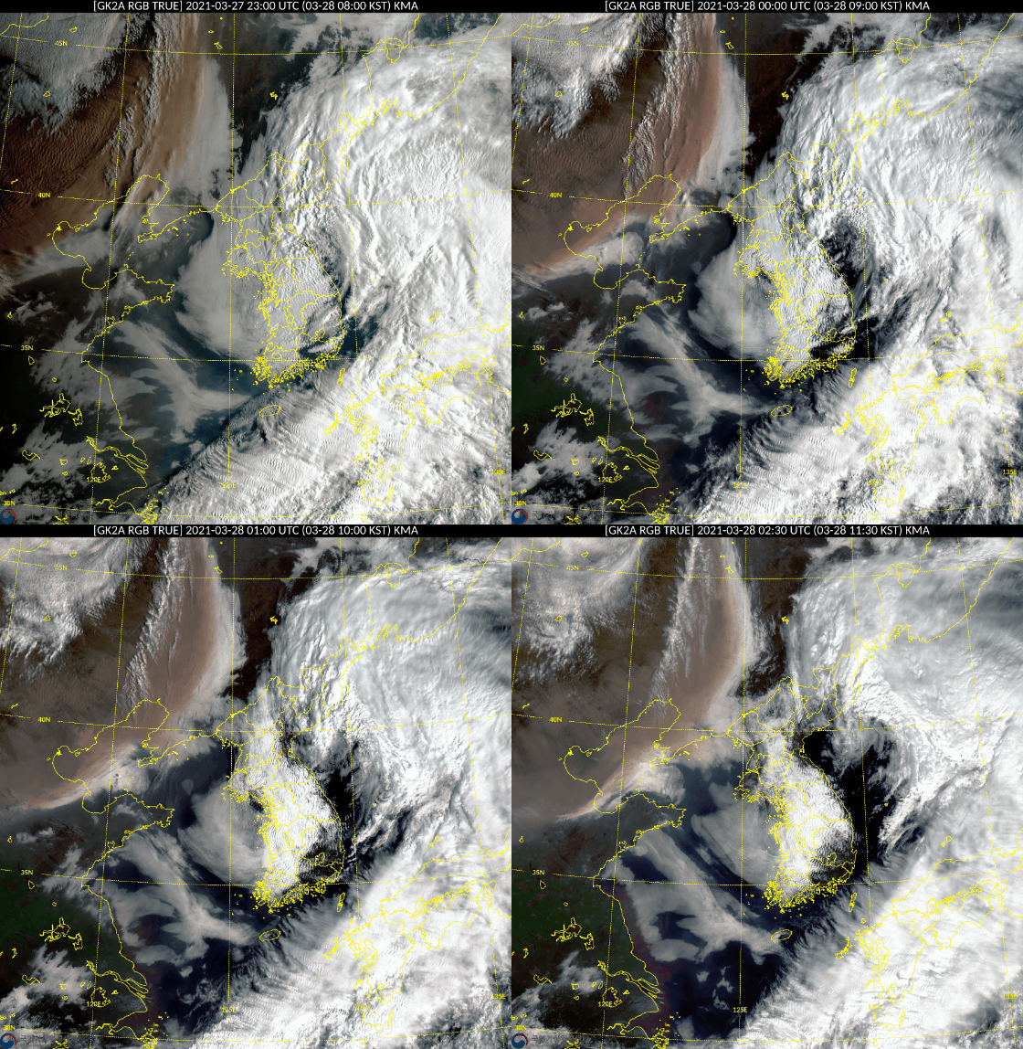
The movement of yellow sand observed from the Korea Meteorological Administration’s Cheonrian 2A satellite. A cloud of yellow dust is approaching the Korean Peninsula from northeastern China. Meteorological Agency
As yellow dust originated from Mongolia and China flows into Korea again, it is expected that the concentration of fine dust will soar to the level of’very bad’ nationwide from the 28th. There is also a forecast that high concentrations of fine dust will continue until the end of this month as the atmosphere congestion in Korea overlaps.
According to the Meteorological Administration on the 28th, from the 26th to the 27th, yellow dust originated from all over Mongolia and the highlands of Inner Mongolia, China, approaching the Korean peninsula. The Meteorological Administration’s Chunlian 2A satellite also found a widespread dust cloud moving from Beijing, China to Manchuria, to the Korean Peninsula. In the case of Beijing, which entered the area of yellow dust from this morning, the concentration of fine dust (PM10) soared to 2523㎍/㎥.

On the 28th, yellow dust hit, and the sky in downtown Beijing, China, turned hazy. EPA=Yonhap News
This yellow dust is expected to enter the country late at night, starting with the 5th island in the west sea, and it is expected that the whole country will be affected by the yellow dust on the 29th and 30th. An official from the Meteorological Administration said, “It seems that the origin of the yellow sand is stronger than the yellow sand that originated in mid-March.” .

The expected concentration of fine dust (PM10) at 6 am, 12 pm, and 6 pm on the 28th from the left. Yellow is’bad’ and red is’very bad’. National Institute of Environmental Sciences Air Quality Integrated Forecast Center
Accordingly, the concentration of fine dust on the 29th is expected to record a’bad’ level nationwide. In particular, in the metropolitan area, Chungcheong, and Jeonbuk, the concentration of fine dust will rise to the level of’very bad’ due to yellow dust in the morning, and the concentration of other regions will also rise to’very bad’ temporarily.
In particular, while the concentration of fine dust (PM10) was high when yellow dust was introduced on the 16th, the concentration of ultrafine dust (PM2.5) with small particles is expected to soar to the level of’bad’ this time. However, like the previous yellow dust, there is a possibility that the impact of yellow dust in Korea will appear smaller than expected depending on the air current.
Ahn Joon-young, general forecaster of the Integrated Air Quality Forecasting Center of the National Institute of Environmental Sciences, said, “The concentration of ultra-fine dust is expected to be higher because the proportion of ultra-fine dust with small particles is higher than that of the previous yellow dust.” It will fall to the level, so it remains to be seen how much it will affect the country.”
Even atmospheric congestion overlaps… High concentration likely to continue until the 31st

On the morning of the 26th, downtown Seoul is looking hazy. News 1
The problem is that after the introduction of yellow dust, atmospheric stagnation occurs in Korea, which can lead to high concentrations of fine dust for a long time.
The Integrated Air Quality Forecasting Center predicted, “It is expected that the concentration of fine dust will be at a’high’ level as fine dust remaining in the country the day before is accumulated due to atmospheric stagnation and airflow convergence and foreign fine dust is introduced on the 30th to 31st.” .
General forecaster Ahn said, “From the afternoon of the 29th after the rain stops, the Korean peninsula will become sandwiched between the high pressures located on the west and east coasts, and the introduced yellow dust will not escape and will move slowly.” It is expected that the concentration of fine dust will be high until the day.”
Reporter Chun Kwon-pil [email protected]
![]()
