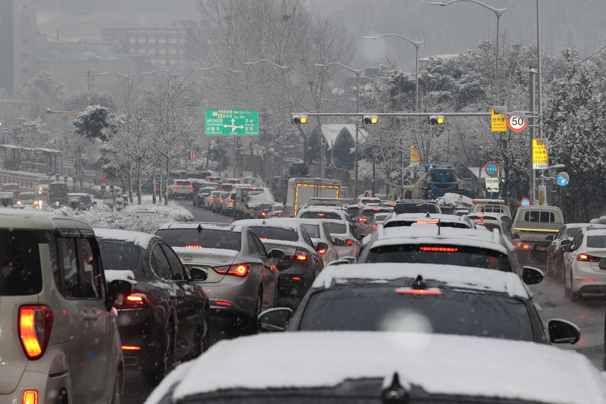
On the afternoon of the 12th, when the heavy snow warning went into effect, traffic congestion due to snow occurred near Namtaeryeong Pass in Gwanak-gu, Seoul. yunhap news
The Meteorological Administration predicted that a maximum of 15 cm of snow would fall in the central region from the afternoon of the 17th to the afternoon of the 18th on the weekend. It is a stronger snow than on the 6th and 12th.
The Meteorological Administration emphasized that preparation for many strong snow could not be ruled out as the possibility of’alarm’, which is the highest level among heavy snow warnings. The heavy snow warning goes into effect when the amount of snow accumulated for 24 hours is expected to exceed 20cm.
The Korea Meteorological Administration said in the online forecast briefing that snow continued until the 18th of the day, due to the effect of the pressure valley passing through the north, the country gradually became cloudy, and snow began to fall in the western part of the metropolitan area including Seoul and the west coast of Chungnam around 3pm After that, it was announced that it will gradually expand to inland. Accordingly, it is expected that a lot of snow will be concentrated in the metropolitan area, Gangwon-do, Chungcheong area, Jeonbuk, northern Jeonnam area, Gyeongbuk area, and western Gyeongnam area from early morning to morning on the 18th.
The snowfall forecast from 3 pm on the 17th to 6 pm on the 18th is about 5-10 cm in eastern Gyeonggi, Gangwon (excluding the east coast), and northern Chungcheong. The Meteorological Administration predicted that there will be places where it falls more than 15 cm.
Snow can accumulate around 2~7cm in the metropolitan areas such as Seoul (excluding eastern Gyeonggi), Chungnam, southern Chungbuk, inland Jeonbuk, and northern Gyeongbuk.
An official from the Meteorological Administration emphasized, “Because strong eyes are concentrated in the metropolitan area and Gangwon Yeongseo during the rush hour on Monday morning, it may cause traffic congestion, so please prepare thoroughly in advance.”
The Meteorological Administration also explained that depending on the situation, there may be a snow pattern such as a’guerilla-like torrential rain’, such as heavy snowfall in a small area. The Meteorological Administration explained that this strong and many snowy pattern is unusual in terms of climate.
The difference is that if it snowed at work time last time, it snowed before work time this time. It is also unusual to see a lot of snow every week.
An official from the Meteorological Administration said, “I cannot affirm that there may be a difference between the times of strong and heavy snowfall, but it is unusual and stronger than before,” and said, “The strong western wind makes it a little bit stronger than the normal winter season.” He explained.
Reporter Han Young-hye [email protected]
