![[내일날씨] Seoul Metropolitan Area Fine Dust Temporary’Very Bad’ Thick fog in the west sea](https://image.news1.kr/system/photos/2021/3/12/4663002/article.jpg "[내일날씨] Seoul Metropolitan Area Fine Dust Temporary’Very Bad’ Thick fog in the west sea")
 |
| © News1 Reporter Lee Jae-myeong |
On Monday the 15th, most regions of the country are warm, around 15 degrees, but the concentration of fine dust is expected to be at a’bad’ level for a week.
The Meteorological Administration predicted on the 14th that “on the 15th, it is at the edge of high pressure moving eastward from the sea in the south of Jeju Island, and is gradually affected by the pressure valley approaching from the north from night.”
The minimum temperature in the morning is expected to be between 1 and 7 degrees Celsius, and during the day, warm southwest winds increase, and the temperature rises to around 15 degrees Celsius in most parts of the country.
Since the temperature difference between day and night is more than 15 degrees, mainly in the inland area, it is necessary to pay special attention to health management such as immunity decline due to rapid temperature change.
The minimum temperature by region is expected to be △5 degrees in Seoul △5 degrees in Incheon △2 degrees in Chuncheon △6 degrees in Gangneung △3 degrees in Daejeon △5 degrees in Daegu △7 degrees in Busan △4 degrees in Jeonju △3 degrees in Gwangju △9 degrees in Jeju.
The expected maximum temperature during the day is △Seoul 16 degrees △Incheon 13 degrees △Chuncheon 15 degrees △Gangneung 18 degrees △Daejeon 17 degrees △Daegu 18 degrees △Busan 17 degrees △Jeonju 18 degrees △Gwangju 18 degrees △Jeju 18 degrees.
There are places where it rains in the Seoul metropolitan area and Gangwon Yeongseo between 9 pm on the 15th and early morning on the 16th due to the influence of the Gapgol. Estimated precipitation is around 5mm in the central region (excluding Yeongdong, Gangwon), Jeolla region, western inland Gyeongsang, Jeju Island, and west sea 5 degrees.
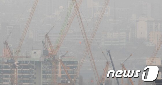
The concentration of fine dust is expected to be’bad’ in the metropolitan area, Gangwon area, Chungcheong area, Gwangju, Jeonbuk, Busan, Daegu, Ulsan, and Gyeongbuk, and’normal’ for other areas. However, the metropolitan area is expected to be at a’very bad’ level temporarily in the morning.
It is expected that the concentration will be high in most regions as fine dust remains the day before and fine dust accumulates due to atmospheric stagnation and air currents.
The wave of the sea is estimated to be 0.5 to 1.0 m off the west and south seas, 0.5 to 1.5 m off the east sea, and the maximum wave height in the far sea is 1.5 m to the west and south seas, and 2.0 m to the east sea.
In the west coast area and in the central inland, there are places where the visibility distance is 200m, and dense fog occurs, and on some west coasts where sea fog flows, the visibility distance changes to less than 50m.
The Meteorological Administration said, “At airports in the west coast area, there may be disruptions in operation due to heavy fog, so passengers of air transportation are advised to check flight information in advance.”